ARIZONA ROUTE 66 IN ORDER FROM EAST TO WEST
Lupton – Houck – Sanders – Chambers – Petrified Forest / Painted Desert – Holbrook – Joseph City – Winslow – Meteor City – Meteor Crater – Winona – Flagstaff – Bellemont – Williams – Ash Fork – Seligman – Grand Canyon Caverns – Peach Springs – Truxton – Crozier – Valentine – Hackberry – Antares – Kingman – Golden Valley – Oatman – Golden Shores – Topock
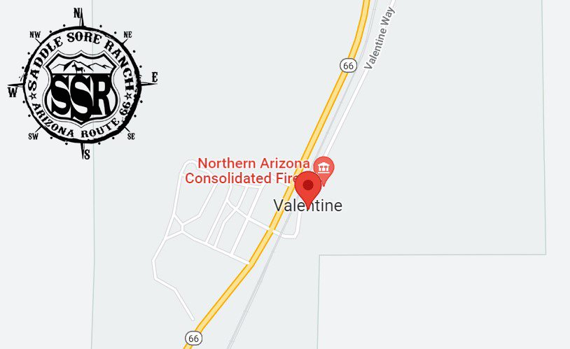
Valentine is an unincorporated community and census-designated place (CDP) in Mohave County, Arizona, United States. As of the 2020 census it had a population of 39. Valentine is located on Arizona State Route 66 (former U.S. Route 66) 32 miles (51 km) northeast of Kingman. The majority of Valentine is located in a geographically isolated portion of the Hualapai Reservation.
The Valentine Elementary School District serves the communities of Valentine, Truxton, Crozier and a portion of Hackberry. It has its single K-8 school in Truxton. When the school was first established, it was in Valentine itself. The Valentine Campus was closed in 1969, and classes were moved to Truxton.
The Bureau of Indian Affairs operated the Truxton Canyon Training School in Valentine from 1903 to 1937. The BIA continues to have an office in Valentine. (source: Wikipedia)
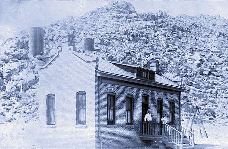
This structure housed the boarding school office and US Post Office. The Post Office was established in 1901 as Truxton. The name was changed in 1910 to Valentine, in honor of Commissioner of Indian Affairs Robert G. Valentine (1872-1916). When the school closed, the post office moved off reservation, two miles away, to the service stop on Route 66. The old post office building is one of the few survivors from school days. The boarded-up classroom is also still there. A short distance away the Truxton Canyon Agency of the US Bureau of Indian Affairs now maintains its offices. Non-Indian children used a nearby wood frame building called the Red Schoolhouse 1924-1969.
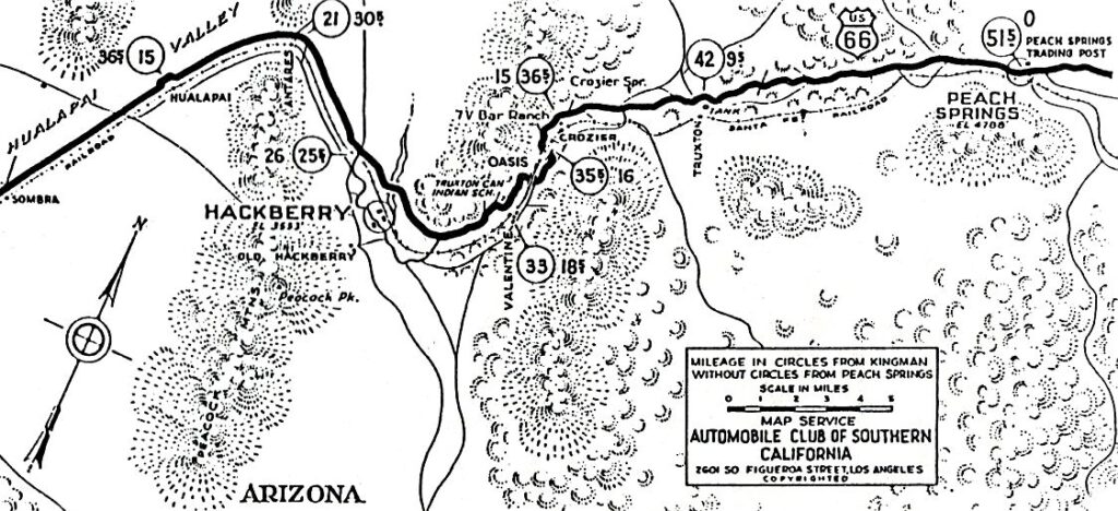
The Automobile club of Southern California 1932 guidebook to Route 66 maps the area around Valentine. The location of the future Valentine service stop on the highway is identified as “Oasis,” watered by a nearby spring. Later there would be an “Oasis Store” at Valentine. The only Valentine on this map, however, is Valentine siding on the railroad. Notice how the dirt road that was US 66 crossed under the railroad at Crozier by following a side drainage under a bridge and then returned to the west side of the tracks via another underpass before the school. Route 66 was a slow and winding road back then, subject to closure during flood or heavy snowfall. By making deep grade cuts, the highway was straightened 1936-37 to avoid flooding and no longer crossed under the tracks. In 1937, the route through Truxton Canyon was the last section across Arizona to be paved. At the same time the government school closed and Oasis became the new location for the Valentine post office.
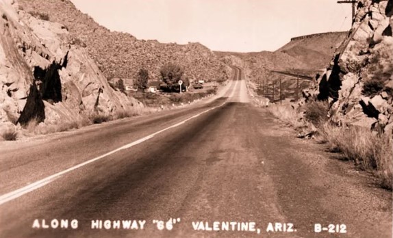
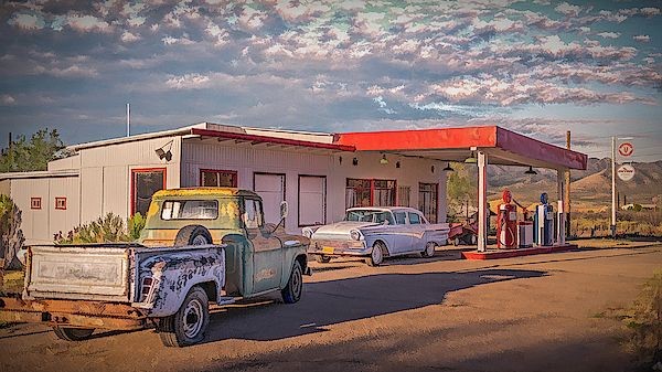
The service stop of Valentine was built on private land about a mile west on Route 66 (actually south at this point) from the Crozier depot. You can see the Santa Fe tracks at right and a Texaco station on the west side of the highway (view is to NNE). In addition to cabins for spending the night, for a time there was also a small store. It was called Oasis Store when operated by Mr. & Mrs. William Scaggs in the 1950s. The school was located almost two miles west of here on the highway.
At some point, the Valentine post office began re-mailing holiday cards for postal customers, applying a unique heart-shaped cancel to the stamp. Soon, bundles of valentines from all across the country would arrive at the remote post office, spreading fame for the Arizona place name. For a time, Valentine, Arizona became associated with happy thoughts. Traffic on Route 66 increased every year after World War II until the new Interstate-40 freeway bypassed 159 miles of Route 66 from Ash Fork to Kingman. The freeway bypass opened 22 September 1978, leading to the immediate decline of business along the old alignment of Route 66. US Highway 66 was decommissioned as a federal highway in 1985. In 1990, Congress began the process to designate Route 66 remnants part of a historical transportation corridor with US Park Service interpretation. In August of that same year, a man robbed the Valentine Post Office and murdered Postmaster Jacqueline Ann Grigg. The post office and Union 76 station closed, located at that time at least three miles west of the old Oasis site according to one source, close to Valentine siding on the railroad.
(additional source: https://arizona100.wordpress.com/2011/08/12/314/ )

Proceeds from our gift shop help with the expenses of maintaining the website. Thank you for taking the time to look around.
***Links provided on this site to Chambers Of Commerce, Route 66 Historical Associations, Visitor Centers, Points Of Interests, etc are provided for your reference and convenience only. They are not affiliated with this site in any way, unless otherwise noted. This site is independently owned, operated and funded as a community service by Rob Borden, the Saddle Sore Ranch, and thru any donations we receive. Donations can be made via PayPal to LiveFromSSR@gmail.com or via Venmo to @SaddleSoreRanch


Click the map image below to open Google Maps of this area.