ARIZONA ROUTE 66 IN ORDER FROM EAST TO WEST
Lupton – Houck – Sanders – Chambers – Petrified Forest / Painted Desert – Holbrook – Joseph City – Winslow – Meteor City – Meteor Crater – Winona – Flagstaff – Bellemont – Williams – Ash Fork – Seligman – Grand Canyon Caverns – Peach Springs – Truxton – Crozier – Valentine – Hackberry – Antares – Kingman – Golden Valley – Oatman – Golden Shores – Topock
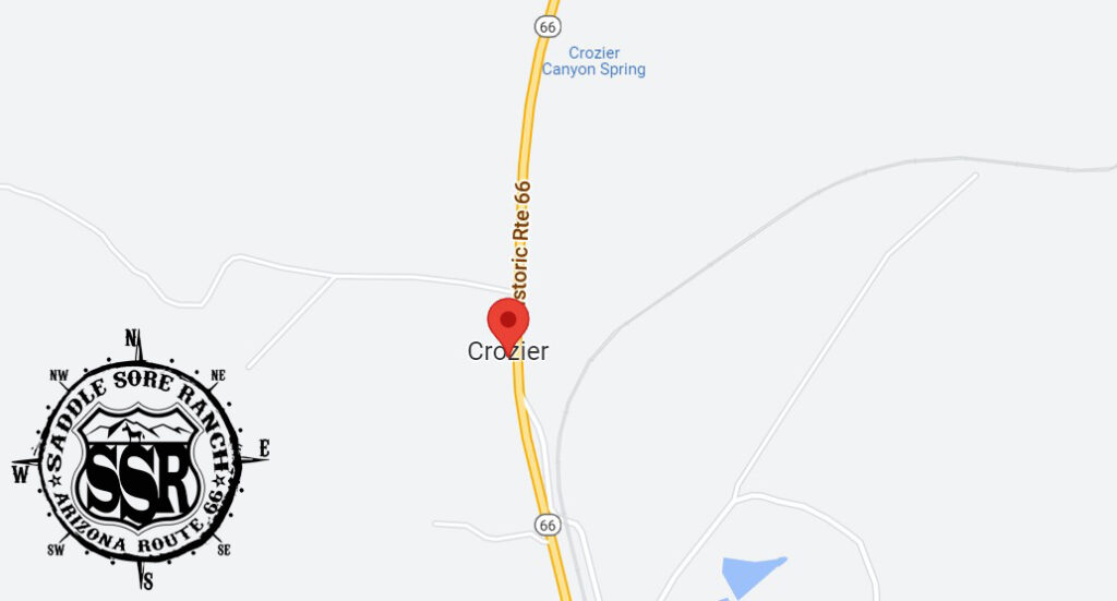
Crozier is located in eastern Mohave County, along Arizona State Route 66, the former US 66. It is 35 miles (56 km) northeast of Kingman, the county seat, and 52 miles (84 km) northwest of Seligman. According to the United States Census Bureau, the CDP has a total area of 1.05 square miles (2.7 km2), all land. (source: Wikipedia)
Crozier is an unincorporated community and census-designated place (CDP) in Mohave County, Arizona, United States. The population was 21 at the 2020 census.

Proceeds from our gift shop help with the expenses of maintaining the website. Thank you for taking the time to look around.

***Links provided on this site to Chambers Of Commerce, Route 66 Historical Associations, Visitor Centers, Points Of Interests, etc are provided for your reference and convenience only. They are not affiliated with this site in any way, unless otherwise noted. This site is independently owned, operated and funded as a community service by Rob Borden, the Saddle Sore Ranch, and thru any donations we receive. Donations can be made via PayPal to LiveFromSSR@gmail.com or via Venmo to @SaddleSoreRanch


Click the map image below to open Google Maps of this area.